|
In a New York Magazine piece "The Uninhabitable Earth," journalist David Wallace-Wells depicts a scary doomsday scenario for human existence if climate change spirals out of control. This super pessimistic piece has indeed stirred up quite some controversies surrounding the likelihood of this scenario among climate scientists. To respond to criticisms, the magazine published an annotated edition. As alarming as this piece reads, it is drawing upon from many scientific studies. The author presents a wide range of possibly catastrophic impacts of climate change on the human civilization: from decreasing agricultural output to outbreaks of epidemics, from the "time bomb" - melting of permafrost to ocean acidification leading to massive coral dying, from violence of crimes and wars to ultimate economic collapse, all of which are due to the temperature rise.
For many years, climate change has stayed in the back burner as a typical lukewarm issue. The scale of this problem is too grand in both time and space, which makes it often stay out of our immediate sight. After all, we have limited mental resources and energies. The classic image to portray climate change is a polar bear standing on an isolated ice, apparently indicating the fast pace of ice melting in the pole due to temperature rise. This kind of images can evoke some visceral reactions among animal lovers but they are hard to appeal to sympathy at a mass scale, because they are so distant from many people's everyday lives. Scientists have been trying to reach a large audience. But by the virtue of their training, they are not allowed to use vivid languages to describe their empirical findings or model projections. Attempting to project an objective image, they use numbers and probability percentages that are elusive to many laymen. Now, science journalists are trying to play the role in bridging scientists and the public. The description in this article is certainly more vivid than what plain numbers can capture. I do not know how likely this grim scenario will unfold in the near future. One thing I'm certain of is that we are visual species, naturally drawn to stories that can project vivid images. The strong reaction among readers, the articled has become the most-read article in the Magazine's history, proves it.
21 Comments
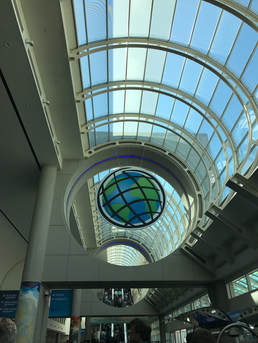
7/14/2017 1 Comment Back from Esri UC It has been quite an experience at the Esri User Conference. This international conference with more than 10000 attendees and hundreds of information-loaded sessions is the biggest annual event for geogeeks.  Inside the Convention Center, San Diego 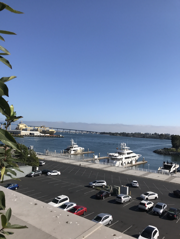 View of San Diego Bay from the Convention Center  Standing at the entrance to the Convention Center 7/10/2017 0 Comments Esri user conference has begun There were many cool presentations loaded with information at the Esri user conference today. Esri co-founder Jack Dangermond kicked off by showcasing many new developments in ArcGIS and innovative applications of GIS in many different sectors. It was exciting to see ArcGIS is providing an even bigger platform for many programs to be integrated. Microsoft chief environmental scientist demonstrated how artificial intelligence can be utilized on this collaborative platform to conserve our nature better. Disney animation studio technical director showed how the studio reconstructed believable landscapes by using the tool CityEngine in the Academy award winning movie Zootopia. The keynote speaker, theoretical physicist Geoffrey West used concepts and laws found in biology to explain urban development.
Excited to attend Esri User Conference in San Diego. As the "Microsoft" in the GIS software market, Esri has made the science of where so cool. Thanks to GIS and other spatial analysis techniques, geographers and other professionals can do all kinds of sophisticated analyses from finding an ideal location for a store to identifying certain crime hotspots, to geographically tracking real-time events, etc. With adequate training in GIS, geographers and other professionals can land very decent jobs across various sectors. According to American Association of Geographers, the median annual salary for geospatial information scientists and technologists is over $80,000.
|

|


 RSS Feed